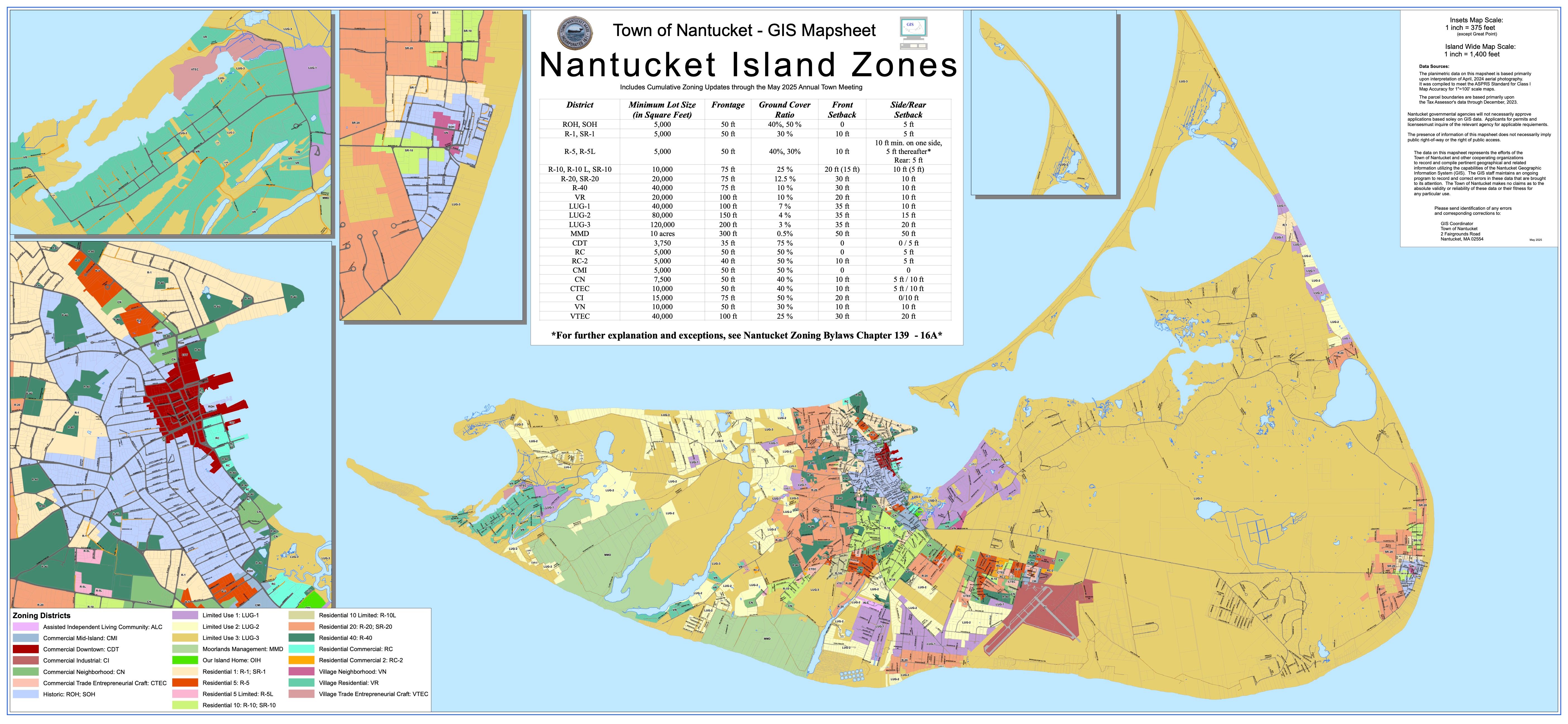
Nantucket Island is one of a kind, especially when it comes on zoning, it is on its own wavelength.
These maps explain planning, property development, and regulatory enforcement, and they typically display:
-Zoning district Boundaries
-Allowed land use (single-family homes, commercial businesses)
-Building regulations (lot sizes, setbacks, height limits)
-Overlay districts (historic districts, flood zones, coastal protection areas)
These maps are maintained by the Nantucket Planning & Land Use Services (PLUS) department and the Nantucket Zoning Board of Appeals. If you’re looking for the latest zoning maps, they can typically be found on the Town of Nantucket’s website.
We know zoning can feel overwhelming. Reach out to one of our agents at LRE, and we’ll guide you through every step of buying a home on the island.